Mannen Haukland Hike — Beach Viewpoint in Lofoten
Mountain peak near Haukland Beach in Lofoten with panoramic views.
Mannen Haukland


Mountain peak near Haukland Beach in Lofoten with panoramic views.
Every place in Norway you'd actually want to see — in under 2 minutes.
Generate free locationsRoughly mid-May to mid-October, when the bare-earth paths are clear of snow and at their driest. Summer adds the midnight sun and long evening light over the two beaches. Outside that season Mannen becomes a winter hike — snow and ice make the exposed summit ridge far more serious, and it is not recommended for casual visitors.
Moderate. The full round trip is about 3.5 km with roughly 390 metres of elevation gain, and most hikers take 2 to 3 hours. It is a steady, fairly steep climb with no technical difficulty for most of the way; the one section that needs care is the final approach, where the path narrows onto a ridge with exposure on the sides.
Hiking shoes with good grip are the most important item — Mannen’s paths are bare earth, not stone or boardwalk, so they get muddy and slippery after rain, especially on the descent. Dress in layers with a windproof, waterproof shell, because the summit and the final ridge are fully exposed and Lofoten weather changes fast. Bring water and a snack — there is nothing to buy along the route.
Most people start from the Haukland Beach parking — a paid car park, busy on summer days, so arrive early for a space. You can also start from the Uttakleiv side, which has its own car park a short distance over the headland. See the cost question below for the parking fees on each side.
The lower and middle sections — the old cart road and the steady climb up the mountainside — are manageable for children who are used to walking uphill. The final approach is the part to think about: the ridge to the summit narrows with exposure on the sides, so younger children should be carried in a proper child-carrier backpack — not walked or held by the hand along that stretch — and in wind or wet weather it is sensible to stop at a lower viewpoint rather than push to the very top.
The hike itself is free — there is no fee for the mountain. The only cost is parking. The Haukland Beach car park is around 40 NOK per hour (with roughly the first 15 minutes free). The Uttakleiv side is more expensive: a car-access fee of around 100 NOK, with parking from roughly 50 NOK for 3 hours and up to about 250 NOK for a full day. Budget for 2 to 3 hours of parking for a normal round trip.
Mannen sits between two beaches, so the summit gives you both at once: Haukland Beach and its white sand to the south, and the wilder, boulder-strewn Uttakleiv to the north. Beyond the beaches you look out over a ring of granite peaks and the open Norwegian Sea — it is one of the most complete coastal panoramas in Lofoten.
Yes. That is exactly why many people do the hike — the summit gives one of the best combined views over Haukland Beach and Uttakleiv Beach.
Yes, in normal conditions, if you are reasonably fit and comfortable with uphill walking. It is not the easiest walk in Lofoten, but for many visitors it is still a realistic and rewarding hike.
The two main beaches beside Mannen are Haukland Beach and Uttakleiv Beach, both of which are worth visiting even without doing the full hike.
The beaches give you the coastline experience from sea level, while Mannen gives you the full elevated panorama over both beaches at once.
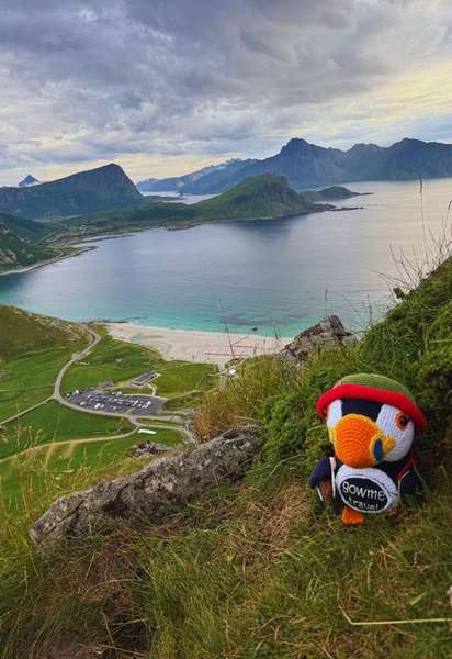
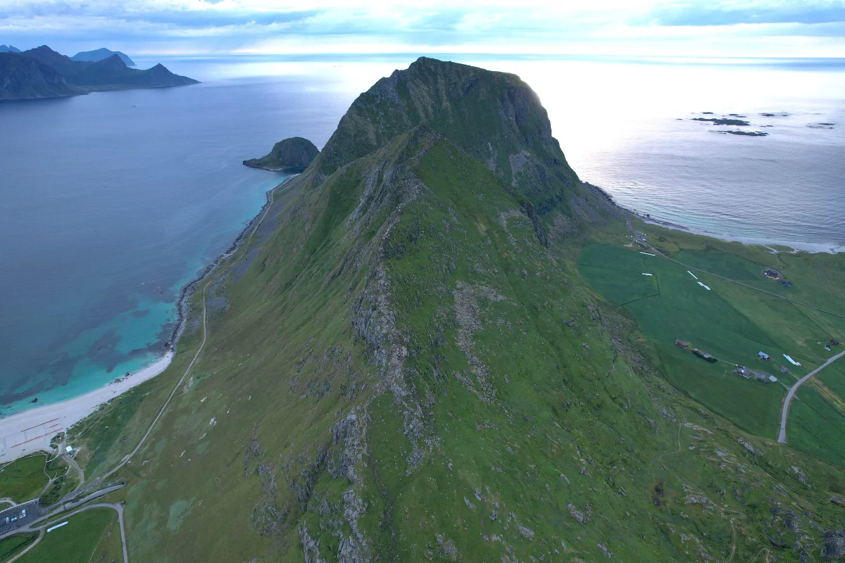
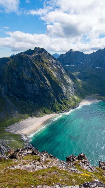
Mannen is a 400-metre mountain on the island of Vestvågøy in Lofoten, and despite its modest height it delivers one of the most rewarding short hikes in the archipelago. Its summit sits directly between two of Norway's most famous beaches — Haukland to the south and Uttakleiv to the north — and from the top both come into view at once: pale, almost tropical-looking sand, water that turns turquoise in sunlight, all of it framed by dark granite peaks and the open Norwegian Sea. That panorama is what puts Mannen on nearly every Lofoten itinerary.
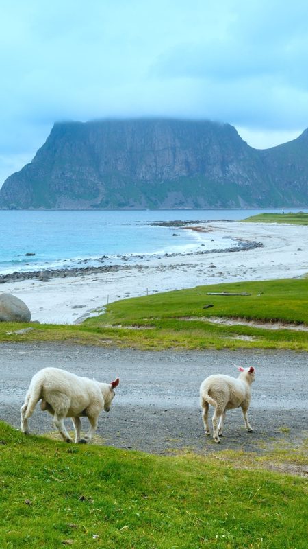
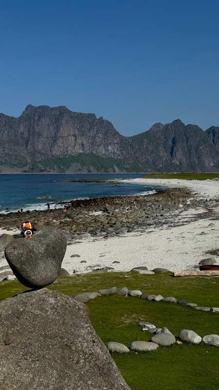
Haukland Beach is regularly ranked among the most beautiful beaches in Norway — a broad arc of white sand and clear, shallow water tucked under steep mountainsides. Uttakleiv, just over the headland, is wilder and more rugged: it is famous for its rounded boulders, its 'eye' rock formation, and as one of the best places in Lofoten to photograph the northern lights. Mannen is the natural high point that ties the two together — from the summit you see the whole stretch of coast at once, which is something neither beach gives you on its own.
The Mannen Haukland hike starts from the car park at Haukland Beach. The first stretch follows an old cart road for roughly 500 metres before a clear path branches off and climbs the mountainside. From there it is a steady, fairly steep ascent: the full round trip is about 3.5 kilometres with around 390 metres of elevation gain, and most hikers complete it in 2 to 3 hours. A fast walker can reach the top in around 45 minutes — most people take longer, partly because the views keep pulling you to a stop.
Mannen is graded as a moderate hike, and for most of the way it is exactly that: a clear, steady climb with no technical difficulty. Two things are worth knowing before you go. First, the paths are bare earth rather than stone or boardwalk, so after rain they turn muddy and slippery — both on the way up and, more awkwardly, on the way down. Second, the final approach to the summit narrows onto a ridge with some exposure on the sides. It is not dangerous in good conditions, but it calls for sure footing and real caution in wind, wet or poor visibility.
There is more than one way to do Mannen. The standard route is the out-and-back from Haukland. You can also start from the Uttakleiv side, which is slightly longer but no harder, or combine the two into a circular route that brings you down to the opposite beach — a good option if you have arranged transport or do not mind the extra walk between the two car parks.
Haukland is a busy spot in summer and the beach car park is paid — around 40 NOK per hour, with a short free grace period — so factor that into the cost of a longer hike. The season for a straightforward Mannen hike runs roughly from mid-May to mid-October, when the paths are clear of snow. Outside that window the same route becomes a winter undertaking, with snow, ice and a far more serious exposed ridge.
Footwear: hiking shoes with good grip. Mannen's paths are bare earth, not stone or boardwalk — after rain they get genuinely muddy and slippery, and the descent is where people lose their footing.
Clothing: layers and a windproof, waterproof shell. The summit and the final ridge are fully exposed and Lofoten weather shifts fast.
The summit ridge: the last stretch narrows with drop-offs on either side. Take it slowly, and turn back if it is wet, windy or visibility is poor — the view is not worth a slip.
Food and water: bring water and a snack — there is nothing on the route. The summit, with both beaches laid out below, is the obvious place to stop and eat.

Nordland · 0.6 km away
View guide →

Northern Norway · 1.1 km away
View guide →

Northern Norway · 7.7 km away
View guide →

Nordland · 14.6 km away
View guide →

Northern Norway · 20.1 km away
View guide →

Northern Norway · 21.9 km away
View guide →
Fluffy™ Norway Trip Planner is built for one thing: turning a messy "somewhere in Norway" idea into a clear route you can actually follow. Tell Fluffy when you're traveling, who you're with, how active you want to be – and the planner curates a custom mix of fjords, viewpoints, easy walks and bigger adventures.
Whether you're starting with classic Oslo attractions and day trips from Oslo, flying to Bergen for some Bergen sightseeing, or chasing the northern lights around Tromsø, Bodø, Narvik or Alta, the planner connects it all into one route. Road-tripping through western Norway around Aurland, Gudvangen, Loen, Olden, Voss and Stryn? Hopping between islands in Lofoten – Svolvær, Leknes, Å i Lofoten, Henningsvær, Hamnøy? Or mixing cities like Stavanger, Trondheim, Kristiansand and Lillehammer with quiet fjord villages? Fluffy keeps the puzzle pieces in order.
After five quick steps, you get a personalized map of Norway with recommended places across northern, western and southern Norway – sent straight to Google Maps. Open it on your phone, tick off spots as you go, and adjust on the fly. You bring the curiosity; Fluffy brings the map.